Taking the road less hiked through the protected Cape Floral Region: Groot Winterhoek Wilderness Area
Every-single-time I drive past a mountain range, I pause to wonder: “What is going on up there?”
Well, this time I am going to find out.
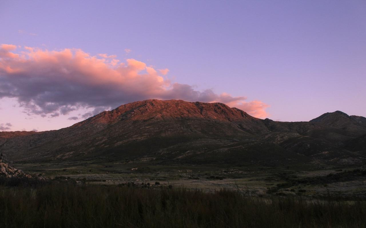
After an early morning departure from Cape Town, we headed out on the N7 and took a right turn at Piketberg, the sun just rising. We then turned left, away from Porterville and exchanged the tarred road for a well-maintained gravel road. Our group of five adventurers, now wide-awake and noticeably excited, taking in the stunning views that the narrow tarred Dasklip Pass provides. Up the pass, we hit the last bit of corrugated gravel road before we saw the Cape Nature reserve sign, signalling our safe arrival at Groot Winterhoek Wilderness Area. This is a true Wilderness area, part of the protected Cape Floral Region and a UNESCO World Heritage Site since 2004.
Finally, we were on top of the mountain after being greeted by two friendly dogs. We got our permits checked at the reserve office before we slung our bags onto our backs, preparing to step out into nature for two blissful days in the mountains. It felt good to be outdoors, the clouds providing the perfect moderate hiking temperature with just a light breeze brushing our cheeks. Our plan for the day was to hike the 23 kilometres from the parking area to Perdelvei via Groot Kliphuis, where we did an overnight in the shelter. Kosie, our designated expedition planner, chose this slightly less hiked route for our first day of hiking. It is slightly longer than the alternative trails and took us deep into the mountains.
Exactly where I want to be.
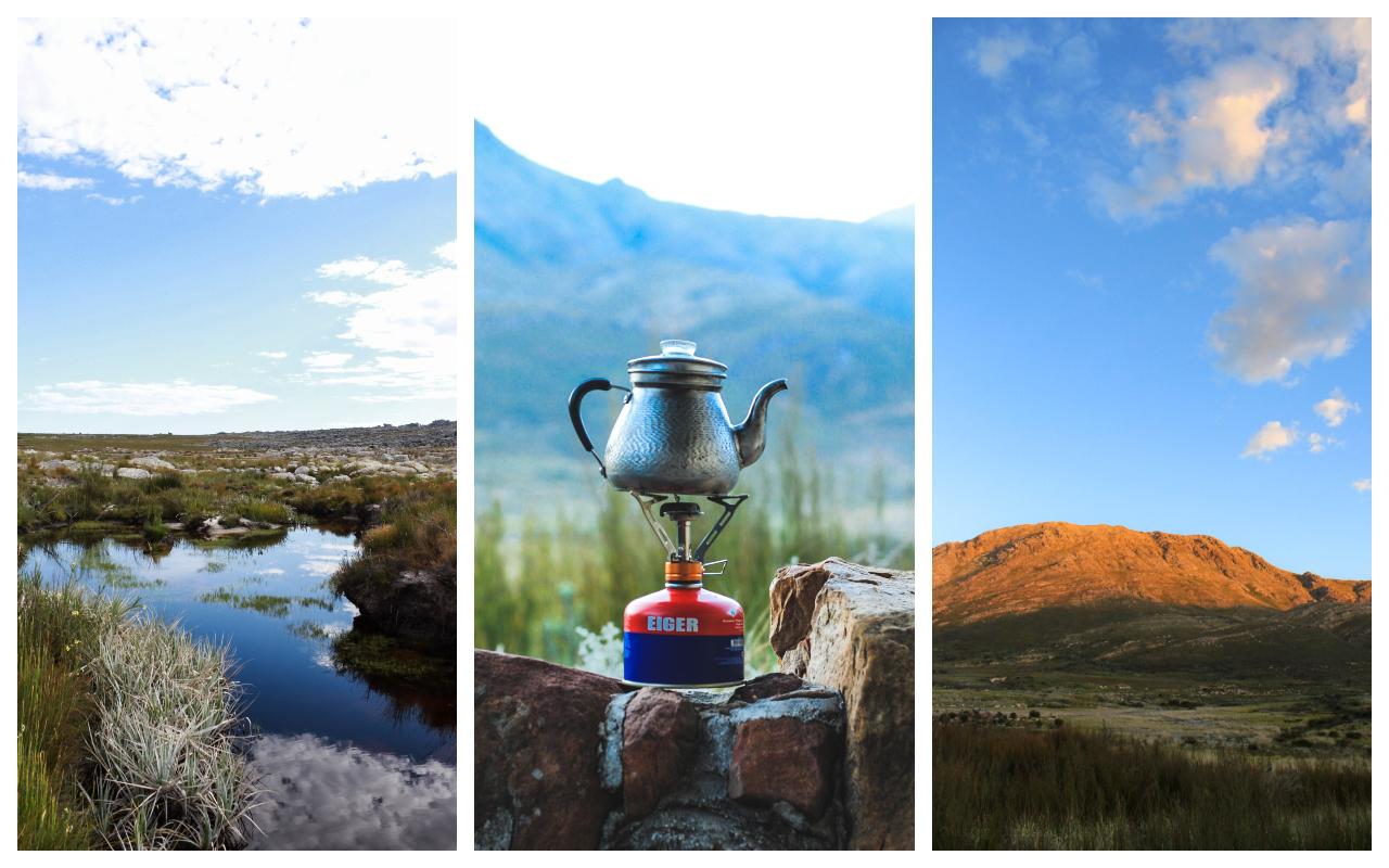
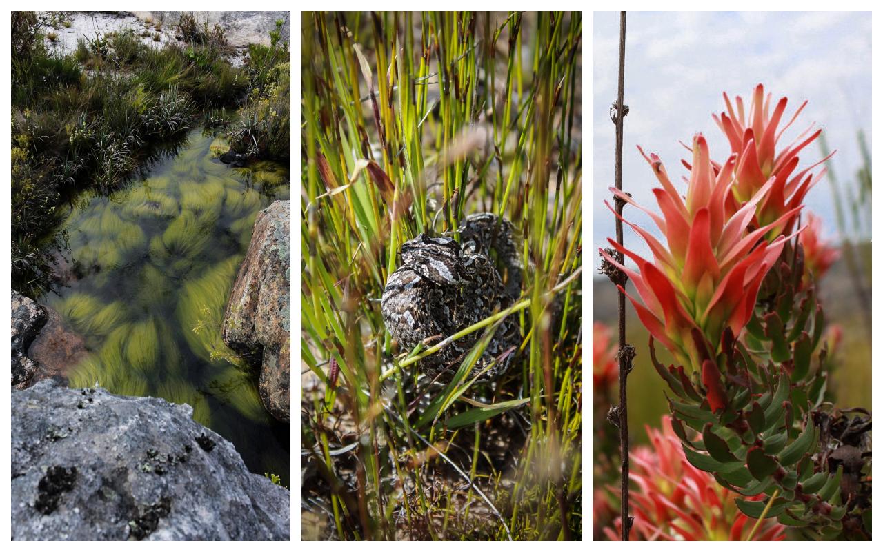
Erland, the veteran hiker in our group led our pack, followed by 11-year-old Ava on his heels. I made up the middle of our pack with Janet and Kosie making up the rear. We crossed our first stream and were greeted by the Disa Pools, the weird and wonderful water grass waving at us, in the flow of the gentle current. This seemed like a good place to pause and fill up our water bottles with the pure mountain water before heading on. We came across a sign pointing to Groot Kliphuis where we turned right, following the well-laid cairns. Unfortunately, after 5 minutes the cairns started to lead us in the wrong direction. We did the only thing you can do in this sort of situation… start again. So we retraced our steps back to the sign. It turns out that all we had to do was forge straight ahead after another look at the map. We suspect the cairns leading of the path might be to more pools.
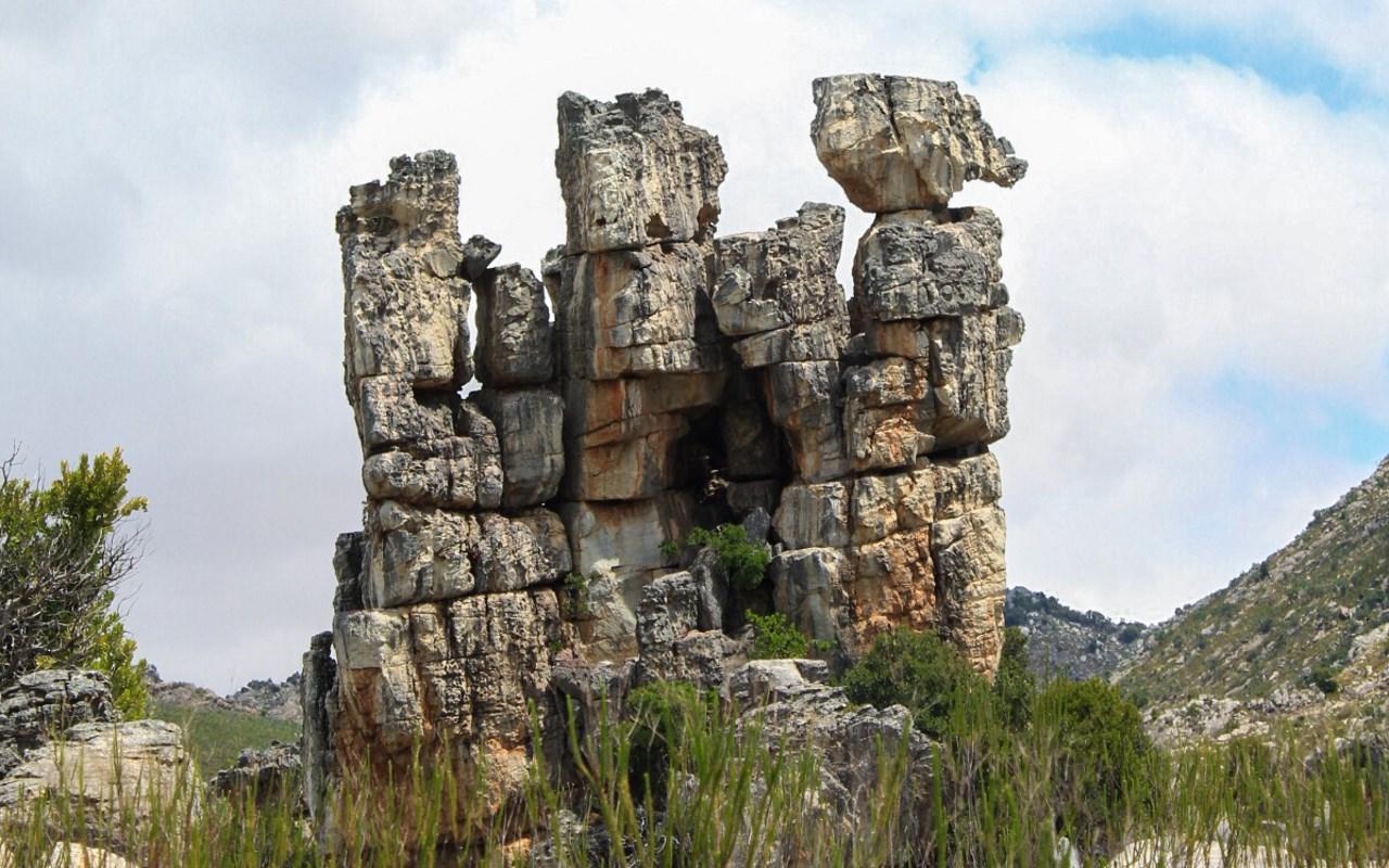
We continued along the river trail for a while before it veered up to the right, snaking up above the river. Gnarled rock formations looked down at us like ancient sentinels as the trail twists and turns between them. We kept a steady pace with only the occasional stop to look for the next cairn, making sure that we're still on the trail. After two hours along the trail, our group had separated. Janet, Erland and I decided to stop next to a bubbling stream for a well-deserved coffee break and a snack. It is mesmerising to sit next to the gentle trickle of water, a cup of freshly brewed coffee in hand while admiring all the life around us.
Cape River Frogs (Family: Pyxicephalidae) plopped into the water. We also spotted the most interesting little insect. It embeds itself into the hollow core of a short piece of grass and then sticks out its head and front legs to propel itself through the water. Almost like a hermit crab.
By this time, Ava and her father had rejoined our group. Everyone back together and refuelled, we packed up and moved on. Rugged mountains and a vast variety of both fauna and flora were all around us. We were lucky enough to spot a juvenile Berg Adder, (Bitis Atropos) thanks to Erland’s trained eye. A beautiful patterned animal that lives mostly at high altitudes, except for here in the Western Cape where they are sometimes spotted at sea level.
We reached another signpost marked Klein Kliphuis. Without consulting the map, (and herein lies the trouble) we took the right turn. A mistake that we would pay for later.
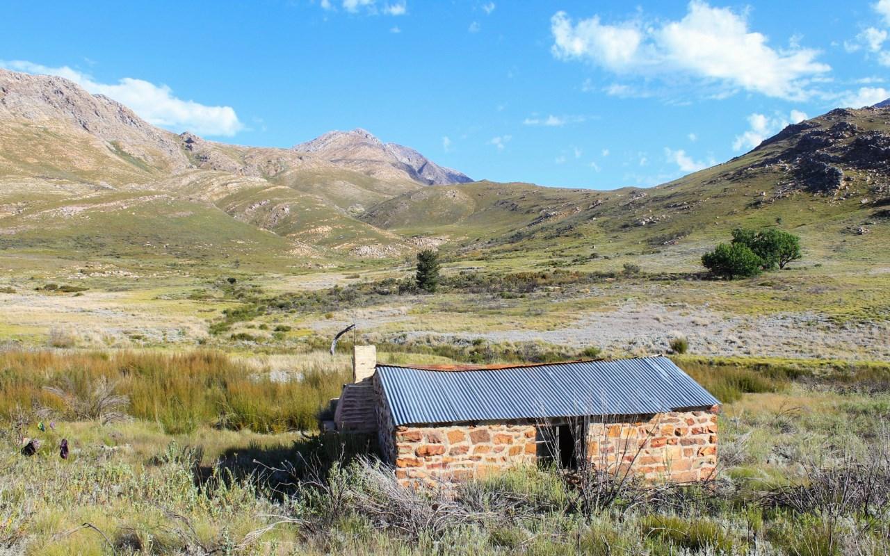
Roughly two hours of hiking along the contour of the mountains, amongst Waboom Proteas (Protea nitida), we made the sloping descent towards a valley with a patch of Bluegum trees. Just beyond the trees, we saw the ruins of a hut built from rock, with a corrugated iron roof caving in. Unsure of exactly where we were, we stopped at a signpost reading Perdevlei, Groot Kliphuis and De Tronk. Pulling out the map, we gathered round to establish where we were since we thought we were heading in the direction of Groot Kliphuis, but the sign shows that it is back in the direction we came from. In addition, we should have been on the jeep track by now.
What concerned us more was that Ava and her dad (Kosie) were separated from us again. So we decided to wait in the hopes that they would catch up to us so that we could figure out where to head next together.
Almost two hours later and there was still no sign of Kosie and Ava. After carefully scrutinising the map, we realised that we had missed the turnoff for the jeep track. Thankfully, there was still a route we could follow. Hoping that our other members did not make the same mistake, we decided to hike on to our overnight accommodation.
This part of the trail is most definitely not hiked very often.
After following a couple of cairns all traces of the trail disappeared. We soon found ourselves bundu- bashing through stinging patches of hikers friend, climbing through dongas (a deep ditch) and having our boots soaked from stepping in marshy ground.
The going is tough.
Four kilometres later, Erland and I spotted our overnight shelter. Overjoyed and shouting, we made a beeline for the hut. Passing some incredible pools, which I was already swimming in (mentally) at that stage, while anxiously in pursuit of unloading our heavy packs. A few hundred metres forward we heard Janet Shouting, “Is daai nie ons hut nie?” she pointed to a hut to our left. We had been so singularly focused on reaching what we thought was our hut we had walked past the emergency shelter tucked behind some tall grass, a few hundred metres away from us. “Perdevelei!” We made it!
Concern was still hovering over us, half of our group still out there somewhere in the mountains.
After sweeping the dirty interior of the emergency shelter, we heard shouts from outside. Kosie and Ava had made it!
I enjoyed my reward after the hard days’ walk; a lovely swim. We settled down on the ‘stoep’ and started preparing supper. Treated to wonderful mountain views all around. Our belly’s full, we sat and admired as the milky way made her way across the night sky. Our expectations surpassed by the grandeur and beauty of the surrounding natural world.
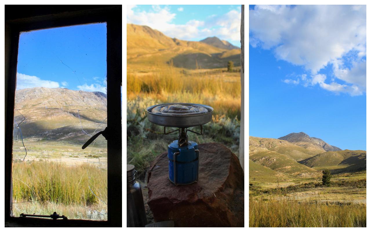
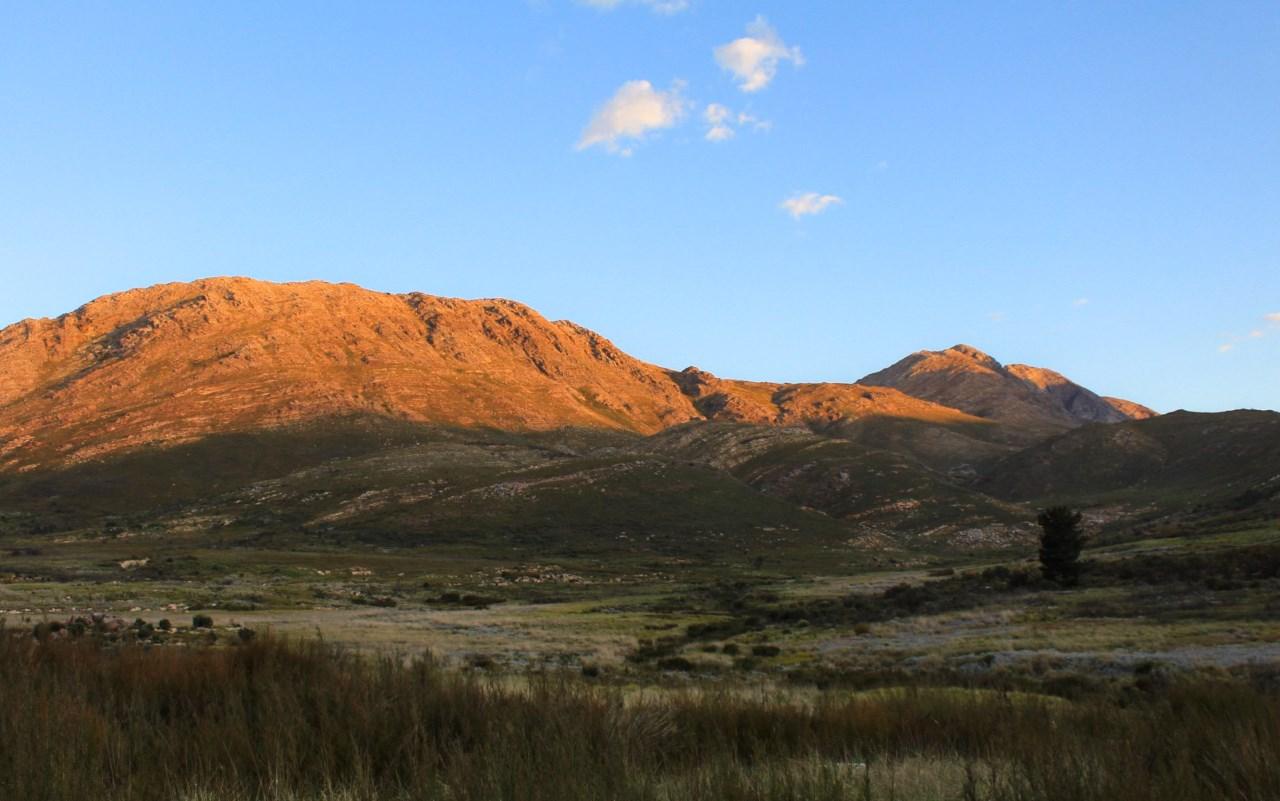
Feeling rejuvenated from a good night’s rest, I made a cup of rooibos tea and found a comfortable spot to sit and watch the sunrise across the landscape. Golden light spilling over the peaks and into the valleys.
Day 2 plan: Hike along Klein Kliphuis to the low-water bridge. Turn right and hike along Groot Kliphuis to the parking area -covering 26 kilometres for our last day.
We learned, with the GPS, that the map slightly overestimates the distance, but it is spot on when it comes to the average trip time as yesterday’s 23km turned out to be closer to 18km, taking us 6 hours, not including stops. Ready for another full day in the mountains, we eagerly launched ourselves back through the 4km section we had come through the previous day.
We made it through the bundu-bash and followed the meanderings of a trail next to the river, the trail was faint, but not as unruly as the previous 4km. Reaching a bend in the Klein Kliphuis trail, we headed up the contours of the mountain. Here we crossed over the top and descended on the other side to the low water bridge.
There is so much joy in taking off your boots and soaking your feet in pleasantly cool water after a few hours of walking. Since we regrouped here, I decided to go for a swim amongst the small fish. A few even came to nibble at my toes while I floated, staring at the brilliantly blue sky. What a way to spend a Sunday morning!
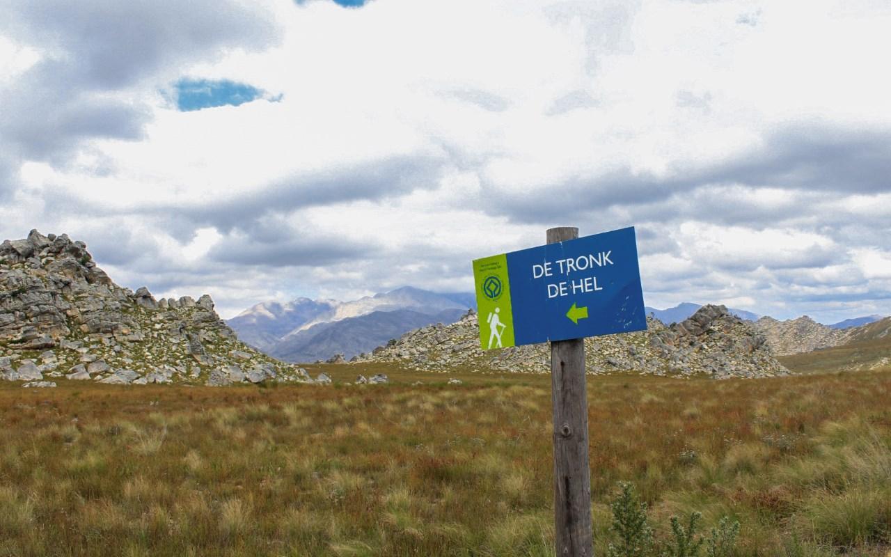
We made sure that everyone was ready for the final push back to the parking area. An estimated 10km. Here the path was in much better condition, being part of the more popular routes to De Tronk and De Hel where rock paintings can be seen. Passing massive pools, I memorised the rock formations and suitable campsites close to the pools on my way back, thinking of future weekend trips I could take.
At the end of the valley, we turned up and trekked over the mountains across a plateau and there it was the Gravel Road. We had made it…well almost. Since there was still a section of road to walk back to the parking area. Luckily for us, Erland went ahead and fetched the bakkie to pick us up.
Weary, but chock full of happiness we headed back to Cape Town. Mission: Exploring what is on those mountains = accomplished!
Bet you're excited to go hiking right about now. Get the gear for it before you go.